An industry update from Inspection.re, premium home inspections across California.
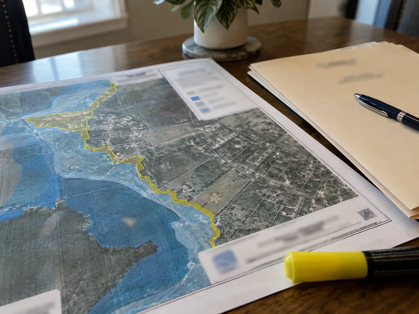
A buyer is a week from closing on a flat lot near a creek channel in the East Bay. The Natural Hazard Disclosure Statement comes back showing the property in a special flood hazard area. The lender emails the next morning asking for a flood insurance binder before funding. The seller has owned the house nineteen years, has never carried flood insurance, and has never had water inside.
Nobody did anything wrong. The map changed. This is a composite of a situation that comes up often, not one identifiable property.
Here is the part that catches people out. The map no longer determines what flood insurance costs. It still determines whether a federally regulated lender has to require it. Those two things used to move together and they no longer do.
The map no longer sets your price, but it still sets whether you must buy
FEMA’s current pricing approach does not use flood zones to determine flood risk. That is FEMA’s own description of how it prices, and it is the single biggest change most buyers and agents have not absorbed.
Rates are built from flood frequency, several types of flooding including river overflow, storm surge, coastal erosion and heavy rainfall, distance to a water source, and property characteristics such as elevation and cost to rebuild. Map data still feeds the catastrophe models behind those rates, and the Flood Insurance Rate Maps, known as FIRMs, still drive the mandatory purchase requirement and floodplain management.
So a zone change now produces two questions that used to be one. Whether the property sits in a special flood hazard area is a mapping and lending question. What a policy costs and covers is a question for a licensed insurance agent, and it does not follow from the first. Keep them in different conversations.
A mapped boundary and a building’s actual behaviour are separate subjects too. A house can sit inside a mapped area with a bone dry crawlspace and thirty years of clean history. A house outside the boundary can have a drainage problem that has been quietly wetting a wall since the patio went in. An inspection report in California describes the second thing. It has never described the first, in the same way it cannot settle what a building code provision requires.
How a flood map actually changes, and why you hear about it last
FEMA issues preliminary Flood Insurance Rate Maps to affected communities, publishes the preliminary flood hazard data for review at hazards.fema.gov, and opens a 90-day appeal period during which residents and businesses with supporting technical and scientific data may appeal the flood risk information.
After that, FEMA issues a Letter of Final Determination. FEMA defines it this way: “The LFD is a letter sent to each affected community stating that a new or updated Flood Insurance Rate Map (FIRM) will become effective on a certain date, and that the community is required to adopt a compliant floodplain management ordinance by that date to remain eligible for participation in the National Flood Insurance Program (NFIP).”
The gap between that letter and the effective date runs about six months. FEMA’s own published record gives a clean example. A batch of Letters of Final Determination dated December 10, 2025 carried a FIRM effective date of June 10, 2026, and California communities were among those covered.
Add it up and the process is public for a year or more, and followed by almost nobody outside the local floodplain office. That is why a buyer usually first learns about a change from a disclosure report or a lender email, long after the appeal window closed. It is not a failure on anyone’s part, it is a mismatch of timescales. The map process runs in months and the transaction runs in days.
A California example of how much time goes by before anyone notices
Alameda County shows the timeline clearly. In March 2025 FEMA delivered preliminary flood maps for Alameda County and the cities of Alameda, Oakland and Piedmont, identifying revised flood hazards along Peralta Creek and the Byron Tract delta. The 90-day appeal period ran from March 29, 2025 to June 28, 2025.
Read those dates as a buyer rather than as an administrator. The window opened and closed on fixed dates, and most people who would eventually be affected were not in the market yet and had no reason to be watching. This is a worked example of how the process runs, not advice about any specific property: a community’s status changes, so confirm the current position with FEMA and the local floodplain administrator rather than relying on a date in an article.
The lesson for an agent is sequencing. Do not wait for a lender to raise it. A transaction can be deep into escrow before anyone reads the hazard disclosure carefully or the lender runs its determination, and by then the calendar is the problem rather than the information. On the flat ground around the bay this comes up more than it does in the hills, and we inspect across it, including Alameda, Newark and Union City. Checking the map and booking the inspection are separate errands, and both belong early.
What the lender is actually required to do
A federally regulated lender must require flood insurance on improved real property located in a special flood hazard area before closing a loan secured by that property. That obligation comes from the Flood Disaster Protection Act of 1973, at 42 U.S.C. 4012a, strengthened by the National Flood Insurance Reform Act of 1994. The amount has to be at least equal to the outstanding principal balance of the loan or the maximum limit of coverage available for that type of property, whichever is less, and it has to be maintained for the term of the loan.
That is why a zone change lands as a lender email rather than a letter from FEMA. The lender is checking whether the loan can close at all, and the buyer experiences it as a sudden request for a binder, usually in the week nobody had spare. The statute sets a floor and nothing more. What a specific lender will accept beyond it, and what a private flood policy covers, are conversations with a licensed insurance agent and the lender.
The practical advice is dull and it works: ask early. A flood insurance question raised days before funding can move a closing date even when the inspection found nothing wrong with the building, because it is a financing event and not a condition event. Treating it as a condition event is how it eats a week. The inspection contingency timeline is a separate clock, and the lender’s requirement does not pause for it.
What California’s hazard disclosure does and does not promise
California’s Natural Hazard Disclosure Statement lists six hazard categories, and the first two are the flood ones: “A SPECIAL FLOOD HAZARD AREA (Any type Zone “A” or “V”)” as designated by FEMA, and “AN AREA OF POTENTIAL FLOODING shown on a dam failure inundation map”. The other four cover fire hazard severity zones, wildland fire areas, earthquake fault zones and seismic hazard zones.
The form then does something unusually honest for a statutory document. It warns, in capitals, that “THE MAPS ON WHICH THESE DISCLOSURES ARE BASED ESTIMATE WHERE NATURAL HAZARDS EXIST. THEY ARE NOT DEFINITIVE INDICATORS OF WHETHER OR NOT A PROPERTY WILL BE AFFECTED BY A NATURAL DISASTER.” It also states that “This information is a disclosure and is not intended to be part of any contract.”
That language cuts both ways. A property just outside a mapped boundary is not a property that cannot flood. A property just inside one is not a property that has flooded. The disclosure reports mapped hazard information. It does not report the building’s water history, and the two are frequently different.
On the mechanics, Government Code section 8589.3 requires flood hazard disclosure on transfer where the transferor has actual knowledge that the property is in a special flood hazard area, or where the local jurisdiction has compiled and posted a list of parcels, delivered through either the Local Option Real Estate Disclosure Statement or the Natural Hazard Disclosure Statement. Civil Code section 1103.2 is where the statement and its categories live. None of that is a decision to make from an article: disclosure wording goes to a California real estate attorney, mapping questions go to FEMA and the local floodplain administrator, and keeping the assignments separate is easier once you have read what a home inspection covers and what needs a specialist.
What a home inspection can tell you about water, and what it cannot
A home inspection is not a flood determination and never has been. California defines a home inspection as “a noninvasive, physical examination, performed for a fee in connection with a transfer … of the mechanical, electrical, or plumbing systems or the structural and essential components of a residential dwelling of one to four units designed to identify material defects.” Flood zone status is not in that job description.
What we can do is read the building’s own history with water, which is often the more useful question. Outside, that means the fall of the ground in the first several feet off every wall, where downspouts and area drains actually discharge and whether that is far enough out to matter, whether area drains have silted closed, whether a stucco weep screed has been buried by raised soil or added hardscape, and whether a slab edge sits lower than the ground around it.
Inside, it is staining, efflorescence and elevated moisture readings at the base of interior walls and in the crawlspace. Rust or a tide line at the base of a furnace, water heater or air handler is frequently the only surviving evidence that water has been in a space before, because carpet gets replaced and drywall gets cut back but nobody swaps the appliance stand. We check whether a sump pump exists, whether it has power, whether its discharge goes somewhere useful rather than back against the foundation, whether the pit shows a silt line above the float, and whether foundation vents or flood openings have been blocked or infilled by a later project.
None of that determines a flood zone. All of it determines whether this building has a history with water, and that is a different question with a more practical answer.
Most of those findings have ordinary causes that have nothing to do with flooding. A buried stucco weep screed traps water in the wall assembly regardless of any map, crawlspace moisture is usually ventilation and ground cover, and grading and drainage after twenty years of added patio is the most common cause of water at a foundation we see. Sorting a leak from a drainage failure is what dampproofing and waterproofing at the foundation is about.
Inspection.re runs premium inspections across California with same-day reports, 3D Matterport tours, drone roof imagery and FLIR infrared scanning, and our inspectors hold InterNACHI Certified Professional Inspector credentials. Infrared scanning and moisture metering are how elevated moisture behind a finished wall gets found before it becomes a demolition question, and the same-day report matters here because a lender-driven flood question compresses a timeline that was already short.
What a buyer should do, in order
Read the Natural Hazard Disclosure Statement the day it arrives rather than the day before closing. The flood line on that form is usually the first warning that a lender is about to ask for a policy.
Then ask three separate people three separate questions and do not let them blur. Ask the lender, early, whether a flood policy will be required before funding, because that is the item most likely to move your closing date. Ask a licensed insurance agent what the lender will accept and what a policy covers. Ask FEMA and the local floodplain administrator whether the mapped status changed recently or is scheduled to. Then ask your inspector a fourth and different question: document the building’s water history. Do not ask us to decide the flood zone, because we cannot and the report will say so.
One thing to know before someone tries to sell it to you: an elevation certificate is not an inspection document. It is a surveyor’s product. If the insurance side of California housing is starting to sound like its own subject, that is fair, and the 2026 wildfire insurance rules and home hardening requirements went the same way for the same reason.
What a seller should do before listing
Find out about a mapped status change before you list, not during escrow. A status that changed during your ownership surfaces at the worst possible moment, when the buyer’s lender runs its determination and the buyer’s agent wants an explanation within the hour.
Check with FEMA and the local floodplain administrator on the current status and any scheduled change, and gather the disclosure information before the listing goes live. If there is a question about what must be disclosed, that is an attorney’s call rather than a judgment to make from a search result. Do not treat nineteen years without water in the house as an answer to the map question, and do not fall for the reverse: a map designation is not evidence that a house has flooded, and the statute’s own warning says as much.
A pre-listing inspection can document the current conditions, including buried weep screeds, blocked openings, silted drains, moisture readings and the signs at mechanical equipment that tell a longer story than anyone’s memory. It cannot produce an elevation certificate or determine a FEMA zone. What is included in the inspection sets out the scope.
Quick questions
Does a new flood map automatically raise my insurance premium?
No. FEMA’s pricing approach does not use flood zones to determine flood risk. What a specific policy costs is a question for a licensed insurance agent.
Can an inspector tell me whether the property is in a special flood hazard area?
No. A home inspection is a noninvasive physical examination of specified residential systems and components, and flood zone status is not part of it. Ask FEMA or the local floodplain administrator.
Does being outside the mapped boundary mean the house cannot flood?
No. The disclosure statement says in its own capitals that the maps estimate where natural hazards exist and are not definitive indicators of whether a property will be affected. Legal disclosure questions go to a California real estate attorney.
What should a buyer ask the lender, and when?
Ask at the start of escrow, not the end, whether a flood policy will be required before funding and what the lender will accept. Federally regulated lenders must require it on improved real property in a special flood hazard area before closing a secured loan.
Does an elevation certificate come from the inspection company?
No. It is a surveyor’s document, and how it applies to your policy is a question for the floodplain administrator and your insurance agent.
The honest summary
The map stopped setting the price and kept setting the requirement, and almost everything confusing about a flood zone change in a California escrow follows from that one split. By the time it reaches a lender email the appeal window has usually closed, and the only live question is what it takes to fund.
The disclosure form identifies mapped hazards and then tells you plainly that the maps estimate where hazards exist. It does not promise a dry house, in either direction. A home inspection documents the building rather than the map: staining, efflorescence, moisture readings, a silt line above a sump float, rust at the base of an appliance, drainage that has been wrong since the hardscape went in. None of that settles a zone and all of it tells you something the zone never will.
So run it in order next time. Read the hazard disclosure when it arrives. Ask the lender about flood insurance in the first week, not the last. Send insurance questions to a licensed insurance agent, map questions to FEMA and the local floodplain administrator, and disclosure questions to a California real estate attorney. Ask your inspector to document water history, which is the part we can answer.
Flood zones are not the only hazard the statutory disclosure list handles imperfectly. A landfill near a property does not appear on that form at all, and California’s new subsurface temperature law gives buyers a defined question to ask instead. On the condominium side, the physical information a buyer is owed arrives through a different statute entirely, and the package already includes the reserve planning and deferred repair statements.
If you want the building documented properly while the paperwork sorts itself out, Inspection.re inspects across California with same-day delivery. How the report works and our frequently asked questions cover scheduling and scope.
The fire side has its own version of this mismatch between the carrier’s paperwork and the physical building. See what the FAIR Plan actually requires to pay a smoke damage claim.