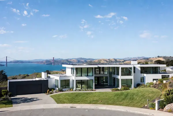
Home Inspection in Union City, CA
The City's own analysis uses the Hayward Fault as a geographic line: level alluvial ground and the urbanized city on one side, steep East Bay hills on the other. Two inspections, one set of city limits.
Union City incorporated on January 26, 1959, formed from Alvarado, which was the first county seat of Alameda County and home to the first successful sugar beet mill in the United States, and Decoto, a railroad town founded the same year, 1870. The City's own environmental analysis describes the Hayward fault as the line dividing the low-lying, nearly level alluvial and estuarine landforms around San Francisco Bay from the steep upland forms of the East Bay hills, with the urbanized land on the western side. That western side sits largely on Rincon clay loam and Clear Lake clay, which the same document calls moderately to highly expansive, with high to very high liquefaction susceptibility in named portions of central and southeast Union City and a moderate potential for subsidence. We built the inspection around all of it.
We inspect across all of Union City
We cover all of Union City: the historic Alvarado district on the west, Decoto on the east side, the Station District around the BART station, Old Alvarado and the blocks along Smith Street, the tract neighbourhoods around Dyer Street, Whipple Road and Alvarado Niles Road, the East End and the streets climbing toward the hills, and the newer building near Union Landing. Area names in common local use are treated as informal, widely recognized areas rather than officially bounded planning districts we have independently verified.
We also serve nearby Newark, Fremont, Hayward, San Leandro, Pleasanton, Dublin, and the broader San Francisco Bay Area across Alameda County. Same premium package, same same-day report, same $300 discount.
What's included on every inspection
We do not break the premium tools out as add-ons. Charging extra for infrared and drone creates a bad incentive. Everything below is standard.
3D Matterport virtual tour with findings tagged inside it
Walk the home from anywhere; every finding links to its exact 3D location. Built for second-home and remote buyers.
Drone roof inspection
Aerial imaging of every roof slope, and a documented look at large or steep roofs, towers, and view decks where ladder access is unsafe, without foot-traffic risk on the roofing.
FLIR infrared thermal scanning
Catches moisture behind walls and ceilings and maps insulation gaps, plus electrical hot spots at the panel and accessible circuits.
LIDAR floor plan
Accurate to-scale floor plan of the entire interior. MLS-ready for listings.
Same-day inspection report
Delivered by email after the inspection ends with photos, the 3D tour link, drone imagery, infrared callouts, the LIDAR floor plan, and a prioritized findings list.
$300 discount applied automatically
Not a coupon code. Just our standard pricing.
The Union City-specific issues we actually look for
A city cut in half by a fault, with expansive clay under most of the flat side and two nineteenth-century cores inside post-1959 stock. This is how we work all of it.
The Hayward Fault is not just a hazard here, it is the line that divides the city
The City's own environmental analysis puts it in geographic terms rather than hazard terms, and that is the most useful way to understand Union City. The Hayward fault divides the low-lying, gently sloping, and nearly level alluvial and estuarine landforms that surround San Francisco Bay from the strongly sloping and steep upland forms of the northwest-trending East Bay hills. West of the Hayward fault the land is urbanized, whereas east of the fault development is sparser. Everything that follows on this page comes from which side of that line a house sits on. The flat urbanized west is a clay and groundwater inspection. The sparser east is a slope and access inspection. They are not variations on one job. On the flats we are reading shrink-swell movement, drainage, and slab behaviour. Going east we are reading retaining walls, surface water that has been collected or simply dumped over a bank, fill placed after construction, and distress in framing and foundation that tracks the downhill direction. We tell clients which inspection they are buying before we arrive, because the time it takes is different.
Clay under most of the flat half, and the City's documentation is specific about it
The Station District environmental analysis reproduces the Natural Resources Conservation Service soil mapping for the area, and the numbers are worth knowing before you read a single crack. Rincon clay loam covers roughly 51 percent of that planning area in the northern portion, Clear Lake clay about 27 percent across the central and eastern portion, and Yolo silt loam about 21 percent in the central western and southwestern portion, with a small amount of Danville silty clay loam in the east. The analysis then states plainly that the Clear Lake, Danville, and Rincon clay and clay loam soils are moderately to highly expansive, and that expansive soils can shrink and swell in response to the presence of water, causing foundation and wall cracks, heaving sidewalks, and creating flaws in paved areas. Expansive clay produces a seasonal signature rather than a single event, and reading it is a pattern-recognition job. We look at whether stucco cracking radiates from stress points like window corners, whether a slab has heaved at one location or settled across a plane, whether interior finish cracking lines up with anything visible outside, whether doors bind at the top on one side of the house and the bottom on the other, and whether irrigation and landscaping have left perimeter moisture wildly uneven from one elevation to the next. We report what the structure shows. We do not classify a soil.
Liquefaction here is patchy, not uniform, and the patches are named
This is where Union City differs from the bayside cities south of it. The City's environmental analysis records that portions of central and southeast Union City are susceptible to high and very high levels of liquefaction, and for the Station District planning area specifically it describes regional mapping from the Association of Bay Area Governments showing areas of moderate and very high liquefaction susceptibility, with most of the area at moderate susceptibility and very high susceptibility in the westernmost extent and in the southeasternmost Gateway subarea. It adds the honest caveat that regional mapping is only a general analysis and that site specific analysis would identify specific liquefaction risk, which is influenced by the depth to groundwater and soil type. The same document flags lateral spreading where high liquefaction susceptibility sits adjacent to an open face or slope. For a buyer that means the answer genuinely changes by neighbourhood, which is not true everywhere. For us it means the liquefaction-related findings get weighted by where in the city the house is, and the parcel-level question goes to a current soils report and a qualified geotechnical engineer rather than to our report.
Moderate subsidence potential, which the neighbouring city does not have
The City's analysis is careful here and we will be too. It notes that Alameda County has not experienced land sinking due to low ground water levels and that USGS mapping of historical and current subsidence does not identify Union City as an area that has experienced subsidence. It then says that the alluvial soils west of the Hayward fault zone, where the flat half of the city is, are considered susceptible to subsidence, and concludes that due to the composition of the soils underlying the planning area there is a moderate potential for subsidence to occur. That is a different finding from the neighbouring city of Newark, whose Safety Element states that subsidence is not considered a risk there, and it is the sort of distinction that gets flattened when someone writes one page for the whole Tri-City area. Subsidence is slow, broad and usually invisible at the scale of a single lot, so an inspection does not detect it directly. What an inspection can do is document whether the building sits level, whether floor slopes are consistent across the structure or localized to one area, whether utility connections at the perimeter have been strained, and whether exterior flatwork has moved relative to the building rather than with it.
Very strong to violent shaking, and a rupture that ran through here in living memory
The City's analysis states that a rupture of the Hayward fault is considered capable of generating a moment magnitude 7.4 earthquake, and that an earthquake matching that scenario is estimated to be capable of generating very strong to violent seismic shaking in the area, in Modified Mercalli terms MM-VIII to MM-IX. The historical record behind that is local and specific: the largest earthquake on the Hayward fault occurred in 1868 with an epicenter south of San Jose, estimated at magnitude 6.8, and surface fault rupture occurred along the Hayward fault from Fremont to San Leandro. Union City sits on that stretch. The USGS working group figure the City cites is a 72 percent chance of a magnitude 6.7 or greater earthquake in the Bay Area between 2014 and 2043, with 14 percent of that attributed to the Hayward and Rodgers Creek faults. The fault also creeps, meaning it slips slowly and continuously between earthquakes, though the clearest documented evidence of that sits in Hayward and Fremont rather than here and those pages cover it properly. What we inspect is anchorage and condition: mudsill bolting where the foundation is visible, cripple wall bracing in any raised-foundation house, post and girder bearing, chimney condition above and below the roofline, and water heater strapping.
Two nineteenth-century towns inside a city that is younger than most of its houses
Union City incorporated on January 26, 1959, formed from two much older communities that had been neighbours since 1870. Alvarado on the west was the first county seat of Alameda County from 1853 to 1865 and was the site of the California Beet Sugar Company, the first successful sugar beet mill in the United States, which began operating in 1870 and was demolished in 1977. Decoto on the east side was founded in 1870 as a railroad town. Around and between those two cores sits a city that mostly went up after incorporation, through the decades that followed. That produces two distinct inspections in one set of city limits. In the older Alvarado and Decoto blocks we expect raised foundations, cripple walls that may or may not have been bolted and braced, original knob and tube or early cloth-sheathed wiring surviving in parts of an otherwise updated house, galvanized supply piping, and additions layered on over a century. In the post-1959 tract stock the findings shift to slab behaviour on expansive clay, service capacity in a panel sized for a smaller decade, aluminum branch wiring in the mid-1960s to mid-1970s band where it appears, and bath fans discharging into an attic rather than through the roof. Same city, same inspector, two different checklists.
Where Union City sits, and what belongs to its neighbours
Union City covers roughly 19 square miles in southern Alameda County with no bay frontage of its own, bounded by Hayward to the north and Fremont and Newark to the south, with the East Bay hills rising behind it east of the fault and the BART Station District as its centre. It is worth naming what belongs to the neighbours rather than to this page. Hayward's story is the fault running under its downtown and the 1930 City Hall it destroyed by creep. Fremont's is an Alquist-Priolo earthquake fault zone crossing five of its districts with offset curbs to prove it. Newark's is a Safety Element that places the entire city inside a liquefaction hazard zone with no landslide areas and no subsidence risk at all. What Union City owns is the combination here: a single fault acting as the physical divider between a flat urbanized half and a hillside half, moderately to highly expansive clay and clay loam under most of the flat side, liquefaction that is high to very high only in named portions rather than everywhere, a moderate potential for subsidence on the alluvial soils, and two nineteenth-century town cores embedded in post-1959 tract stock. Soils, slope, groundwater and construction history still vary lot to lot, and parcel-level questions belong to a current soils report, current hazard mapping and the seller's disclosures.
Pay at Closing — available in Union City
Most inspectors require payment on the day of the inspection. We let you defer the inspection fee until your transaction closes through escrow.
- ●Zero upfront payment required to book.
- ●Full premium inspection delivered today: Matterport, drone, infrared, LIDAR.
- ●$300 discount still applied.
- ●Inspection fee is collected from escrow when the deal closes.
Three ways to schedule
Buyer inspection
Same-day turnaround keeps you inside the contingency window with time for specialty inspectors when the report calls for one. The report is leverage in negotiation.
Schedule a Buyer Inspection →Pre-listing inspection (sellers)
Find issues before the buyer does. The 3D Matterport tour and LIDAR floor plan double as MLS-ready listing assets.
Schedule a Pre-Listing Inspection →Realtor concierge
Same-day reports keep your timelines clean. The 3D tour and floor plan work directly with MLS. Pay-at-Closing removes inspection-fee friction. RESPA Section 8 is a hard line and we don't cross it.
Realtor Booking →How the inspection actually runs
- 01
You schedule online or by phone
Usually one to three days out. Same-day and next-day available for tight contingency timelines.
- 02
We confirm access
With the agent or property manager. Buyers are welcome and encouraged to attend.
- 03
One visit, all the tech
Visual walkthrough, drone roof flight, 3D Matterport scan, LIDAR pass, and infrared sweep all happen during the same visit.
- 04
The full report arrives the same day
By email, with photos, drone imagery, infrared callouts, the 3D tour link, floor plan, and a prioritized findings list.
- 05
You can walk through the findings with us
By phone or in person. For sellers, we can issue an updated report after repairs are made.
Frequently asked questions
Does the Hayward Fault run through Union City?
Is expansive soil really a problem here?
Am I in a liquefaction zone?
We are buying in Alvarado or Decoto. What is different about those houses?
What about the houses up toward the hills?
The house was built in the late 1960s. Should I worry about aluminum wiring?
Do you inspect the sewer lateral?
How long does an inspection take in Union City?
Other service areas
San Jose, CA
Bay Area. Postwar tract housing at scale, annexation-era permit gaps, downtown and creek-corridor liquefaction, Willow Glen Eichlers, no city pre-sale requirement.
See area →Santa Clara, CA
Bay Area. 1950s stock reaching end of life together, Silicon Valley Power service rules, citywide liquefaction zone, expansive clay, condos and townhomes.
See area →Fremont, CA
Bay Area. Five historic townships with five build eras, the Hayward Fault through the middle of town at its junction with the Calaveras, no lateral ordinance.
See area →San Mateo, CA
Bay Area peninsula. Mandatory point-of-sale sewer lateral inspection, bay mud settlement, no fault zone, 2024 flood-map revision, six housing eras.
See area →San Francisco, CA
Bay Area headquarters. Wood-frame Victorian and Edwardian stock, ~45% pre-1940, fog-belt moisture, soft-story garage openings, re-clad walls, and the 3R records gap.
See area →Oakland, CA
Bay Area. Pre-war flatland bungalows and Victorians, hillside downslope construction, Hayward Fault creep, 1991 fire rebuild areas, sewer lateral certificate at sale.
See area →Daly City, CA
Bay Area peninsula. Doelger split-level Westlake tracts, living space over garage, extreme fog-belt moisture, San Andreas proximity, coastal bluff erosion.
See area →Beverly Hills, CA
Greater LA. The Flats 1920s Spanish Revival estates, Trousdale mid-century modern, hillside and gated homes. Santa Monica Fault, landslide zone, luxury-estate scope.
See area →Malibu, CA
Greater LA coast. Septic/OWTS Point-of-Sale scope, Woolsey fire + insurance crisis, beachfront bluff and pilings, canyon landslide. Point Dume to Big Rock.
See area →Pasadena, CA
Greater LA historic. Bungalow Heaven Craftsman, masonry chimneys, cripple-wall retrofit, Raymond Fault, and the Eaton Fire foothill corridor.
See area →San Diego, CA
Anchor city — coastal moisture, canyon drainage, older urban homes, downtown condos, military moves, and North City tracts. All 52 community areas.
See area →Temecula, CA
Anchor city — Wolf Creek to De Luz wine country. Expansive clay, Elsinore Fault, WUI fire zones, hot-summer HVAC stress.
See area →Murrieta, CA
Master-planned community specialists. Bear Creek to Spencer's Crossing. HOA-aware reporting, Chinese drywall checks.
See area →La Jolla, CA
Premium coastal. Mount Soledad slope and Rose Canyon fault, bluff corrosion, luxury estates, historic Village stock. 14 neighborhoods.
See area →Coronado, CA
Island city. Historic Village cottages, 1970s Shores condos, Cays waterfront. Aggressive salt-air, military relocation, flood exposure.
See area →El Cajon, CA
East County value market. 1950s-60s midcentury ranch stock, hot-valley HVAC stress, wildfire-edge checks, Fletcher Hills and Rancho San Diego.
See area →Poway, CA
The City in the Country. Over 75% Very High fire hazard. Cedar Fire and Witch Fire history. Older ranch homes to hillside estates with well-and-septic.
See area →Escondido, CA
Older homes, hillside lots, wildfire-zone properties. North San Diego County, 1950–1985 housing stock.
See area →Wildomar, CA
Rural lots, equestrian properties, older country homes. Well-and-septic experience, SW Riverside foothills.
See area →Lake Elsinore, CA
Elsinore Fault Zone, lakeside cottages, WUI hillsides. From 1920s Lakeshore Drive to Tuscany Hills tracts.
See area →Carlsbad, CA
Coastal salt-air, three-lagoon corridors, La Costa polybutylene era. Village cottages to Robertson Ranch new construction.
See area →Oceanside, CA
Coastal salt-air, Camp Pendleton moves, Fire Mountain hillsides, South O cottages, and Rancho Del Oro tract homes.
See area →Menifee, CA
Sun City 55-plus accessibility scope, Audie Murphy Ranch master plan, Mello-Roos CFD awareness, and hot-summer HVAC sizing checks.
See area →Encinitas, CA
Cardiff bluff stability, Coastal Commission jurisdiction, Olivenhain equestrian properties, and five distinct communities from 1920s cottages to Encinitas Ranch tracts.
See area →Chula Vista, CA
South Bay coverage. Eastlake and Otay Ranch master-planned systems, Mello-Roos and CFD awareness, older west-side stock, and hot-summer HVAC on the eastern slopes.
See area →Riverside, CA
Inland Empire county-seat anchor. Historic Wood Streets and Mission Inn-area old homes, Canyon Crest hillsides, Orangecrest tracts, and hot-summer HVAC.
See area →Vista, CA
Inland North County. Shadowridge aging tracts, Buena Creek rural-edge lots, older downtown homes, wildfire-edge readiness, and inland HVAC load.
See area →San Marcos, CA
North County Inland. San Elijo Hills fire zone, Mello-Roos, Twin Oaks rural lots, Lake San Marcos 55+.
See area →La Mesa, CA
Jewel of the Hills. 1920s Village bungalows, Mount Helix slope estates, older systems, sewer-scope market.
See area →National City, CA
Second-oldest county city. Brick Row historic core, Mills Act, dense older stock, military/relocation.
See area →Santee, CA
East County valley. San Diego River flood exposure, Carlton Hills and Carlton Oaks aging tracts, hot-valley HVAC, wildfire-edge slopes, and manufactured-home stock.
See area →Lemon Grove, CA
Postwar East County. 1940s-60s ranch and Spanish-style homes, aging systems near end of life, sewer lateral issues, trolley-corridor multi-unit stock, and East County summer HVAC.
See area →Imperial Beach, CA
Southwest coastal. Salt-air corrosion, FEMA flood zones, high water table, older beach cottages, Tijuana River Valley awareness, and bayside condos.
See area →Solana Beach, CA
North County coastal. Blufftop erosion and seawall awareness, Coastal Commission jurisdiction, Cedros Village cottages, Lomas Santa Fe slope homes, and salt-air corrosion checks.
See area →Del Mar, CA
Premier coast. Bluff erosion + LOSSAN rail, lagoon flood, Coastal Commission, Olde Del Mar estates, luxury scope.
See area →Canyon Lake, CA
Gated lake community. 1970s-90s housing stock, hillside and waterfront lots, Elsinore Fault proximity, HOA-aware reporting.
See area →Perris, CA
Two markets in one city. Historic Downtown Perris railroad stock and new tracts on expansive clay. Post-tension slabs, hot-summer HVAC.
See area →Fallbrook, CA
Rural estates, avocado groves, well-and-septic dependence, WUI fire zones. De Luz to the Village core. Outbuilding and ag infrastructure scope.
See area →Bonsall, CA
San Luis Rey valley equestrian estates, river floodplain, well-and-septic, hillside custom homes, WUI fire exposure. Gated enclaves and rural parcels.
See area →Hemet, CA
55+ communities and manufactured homes alongside 1960s-80s ranch stock moving through investor flips. San Jacinto Fault proximity, extreme-heat HVAC.
See area →San Jacinto, CA
San Jacinto Fault Zone, Alquist-Priolo disclosure, 2000s boom-tract construction, river floodplain, expansive soils. Seismic and water exposure combined.
See area →Rancho Santa Fe, CA
Estate-grade inspections. Covenant Lilian Rice adobes, multi-structure parcels, septic on estate scale, eucalyptus WUI fire exposure, historic layered additions.
See area →Los Angeles, CA
Greater LA anchor. Hillside foundations and caissons, a dozen active faults, soft-story retrofit ordinance, and a century of building eras from Craftsman to new infill.
See area →Long Beach, CA
Greater LA coast. Newport-Inglewood Fault and 1933 quake legacy, Wilmington oil-field methane zones, Naples waterfront, historic Craftsman and Spanish stock.
See area →Santa Monica, CA
Greater LA premium coast. Santa Monica Fault, citywide seismic retrofit ordinance, bluff above PCH, soft-story condos, salt-air corrosion.
See area →Irvine, CA
Orange County. Master-planned villages, graded-pad expansive-soil settlement, stucco wall systems and window flashing, tile-roof underlayment, HOA and Mello-Roos.
See area →Newport Beach, CA
Orange County coast. Waterfront seawalls and docks, high tidal water table, FEMA flood zones, salt-air corrosion, Newport-Inglewood Fault, luxury rebuilds.
See area →Huntington Beach, CA
Orange County coast. Newport-Inglewood Fault, oil-field wells and methane overlays, liquefaction-zone soil, salt air, Huntington Harbour waterfront.
See area →Anaheim, CA
Orange County. Postwar tract boom, mid-century systems, asbestos-era materials, aging panels and plumbing, Anaheim Hills slopes, Santa Ana River soil.
See area →Santa Ana, CA
Orange County. Historic districts, pre-1980 stock, clay sewer laterals and root intrusion, original wiring, galvanized supply, asbestos-era materials.
See area →Fullerton, CA
Orange County. Historic Golden Hills, Sunny Hills and Raymond Hills slopes, Craftsman and mid-century stock, masonry chimneys, original systems.
See area →Tustin, CA
Orange County. Old Town historic core, 1990s Tustin Ranch copper-era tracts, dual-pane window seal failures, North Tustin hillside estates.
See area →Orange, CA
Orange County. The largest historic district in California, Eichler mid-century tracts, postwar ranches, masonry chimneys, copper and dual-pane aging.
See area →Costa Mesa, CA
Orange County. Eastside cottages and mid-century tracts, dual-pane window seal failures, copper pinhole leaks, heavy remodel and permit questions.
See area →San Bernardino, CA
Inland Empire. San Andreas and San Jacinto faults, valley liquefaction, cripple-wall seismic readiness, older and postwar stock, extreme inland heat.
See area →Rancho Cucamonga, CA
Inland Empire. Post-tension slab foundations, Cucamonga Fault foothills, alluvial-fan drainage, stucco systems, tile-roof underlayment, master-planned tracts.
See area →Ontario, CA
Inland Empire. Historic Euclid Avenue downtown and the Ontario Ranch master-planned new-build south, expansive soil, stucco moisture, inland heat.
See area →Burbank, CA
Greater LA. Studio-era 1920s-1950s stock, lead paint and asbestos-era materials, unreinforced masonry chimneys, aging electrical and plumbing, Verdugo foothills.
See area →Glendale, CA
Greater LA. Historic and foothill homes, unreinforced masonry chimneys, Sierra Madre and Verdugo faults, hillside wildfire, slope and debris flow.
See area →La Cañada Flintridge, CA
Greater LA. Foothill WUI wildfire and debris flow, Sierra Madre fault, custom hillside and older homes, masonry chimneys, slope and retaining.
See area →Arcadia, CA
Greater LA. New luxury teardown-rebuilds, graded-pad and fill settlement, Raymond fault, foothill fire, older Santa Anita stock.
See area →San Marino, CA
Greater LA. Architect-designed 1920s-1930s Period Revival estates, undersized original electrical, masonry chimneys, Raymond fault, mature trees.
See area →Sierra Madre, CA
Greater LA. Historic foothill town, WUI wildfire exposure, unreinforced masonry chimneys, canyon-lot slope and drainage, older systems.
See area →South Pasadena, CA
Greater LA. Pre-1940 Craftsman stock, raised foundations and cripple walls, the Raymond fault, older electrical, plumbing, and heating.
See area →Alhambra, CA
Greater LA. 1920s-1940s bungalow and Spanish stock, original gravity heating, raised foundations, undersized electrical, dense historic neighborhoods.
See area →Monrovia, CA
Greater LA. Old Town Victorians and Craftsman, raised foundations, foothill wildfire exposure, masonry chimneys, aging older-home systems.
See area →Torrance, CA
Greater LA / South Bay. Postwar slab tracts, the Torrance oil field and methane context, the Hollywood Riviera coast, Old Torrance bungalows.
See area →Manhattan Beach, CA
Greater LA / South Bay. Multi-level Sand/Tree/Hill section homes, roof decks and balconies, deck waterproofing, salt air, sandy soil.
See area →Redondo Beach, CA
Greater LA / South Bay. The Avenues, Hollywood Riviera, King Harbor condos and townhomes, coastal corrosion, decks, hillside slope.
See area →Sherman Oaks, CA
Greater LA / San Fernando Valley. Mid-century modern and ranch homes, flat roofs, post-and-beam, radiant slabs, hillside lots south of the boulevard.
See area →Encino, CA
Greater LA / San Fernando Valley. Sprawling ranch and mid-century estates, Encino Hills, pools and spas, flat roofs, hillside slope, large systems.
See area →Van Nuys, CA
Greater LA / San Fernando Valley. Postwar ranch tracts, garage conversions and unpermitted additions, older systems, multifamily and rental stock.
See area →Thousand Oaks, CA
Ventura County / Conejo Valley. Master-planned tracts and hillside custom homes, graded pads, oak-studded slopes, wildland-urban fire exposure.
See area →Simi Valley, CA
Ventura County. Terraced hillside tracts on cut-and-fill pads, old landslide deposits and earth movement, valley-floor slabs over deep alluvium, fire edge.
See area →Camarillo, CA
Ventura County / Oxnard plain. High water table and ground moisture, former farmland, hillside Camarillo Heights, slab and crawlspace dampness.
See area →Culver City, CA
Greater LA Westside. 1920s Spanish and post-war tracts, Culver Crest hillside, Fox Hills condos, Inglewood Oil Field context, mixed-era systems.
See area →West Hollywood, CA
Greater LA. Dense older multifamily, 1920s courtyard buildings, SB 326 balcony law, condo conversions, soft-story seismic, older systems.
See area →Brentwood, CA
Greater LA Westside. Brentwood Park flat-lot estates, Mandeville and Sullivan canyons, Crestwood Hills mid-century, slope, fire exposure, and large older systems.
See area →Pacific Palisades, CA
Greater LA coast. Canyon and bluff homes, Castellammare slope history, wildfire exposure, heavy rebuilds, hillside foundations, and coastal salt air.
See area →Corona, CA
Inland Empire. South Corona hillside master-planned tracts, Green River wind corridor, historic Grand Boulevard circle, fire-edge exposure, and expansive clay.
See area →Fontana, CA
Inland Empire. North Fontana master-planned tracts and older south-side post-war stock, summer heat, Cajon Pass wind on roofs, and expansive soil.
See area →Garden Grove, CA
Orange County. 1950s-60s post-war slab tracts, aging systems, original sewer laterals and root intrusion, unpermitted additions and conversions.
See area →Hermosa Beach, CA
Greater LA / South Bay. Sand Section walk streets, the Strand, Sleepy Hollow, Hill Section, salt air, multi-level coastal structure and waterproofing.
See area →Palm Springs, CA
Coachella Valley. Movie Colony, Twin Palms, Vista Las Palmas mid-century modern homes, pools, extreme HVAC load, and vacation-rental wear.
See area →Fountain Valley, CA
Orange County. 1960s-70s slab tracts, high water table history, Green Valley pools, aging original systems, and compact build-out era.
See area →Chino Hills, CA
Inland Empire. Hillside master-planned tracts, slope and drainage, seismic faults from the 2008 quake, wildfire canyon edge, and expansive clay.
See area →Moreno Valley, CA
Inland Empire. Tract new construction and older Sunnymead stock, extreme summer heat on HVAC, expansive clay, and wind off the passes.
See area →Yorba Linda, CA
Orange County. Hillside and equestrian estates, wildfire and Santa Ana wind exposure, pools and outbuildings, slope, and mixed-era systems.
See area →Eastvale, CA
Inland Empire. Newer master-planned tracts on former dairy land, settlement and soil movement, extreme heat, and near-universal leased solar.
See area →Mission Viejo, CA
Orange County. Mature master-planned tracts from the 1970s-1990s, aging first-generation systems, hillside slope, pools, and HOA-aware reporting.
See area →Redlands, CA
Inland Empire. Historic Victorian and Craftsman stock, masonry chimneys, San Andreas fault foothills, wildfire edge, and expansive clay.
See area →Aliso Viejo, CA
Orange County. 1990s-2000s master-planned tracts and condos on hillside pads, canyon wildfire exposure, shared structures, and aging first-gen systems.
See area →Laguna Niguel, CA
Orange County. Hillside master-planned tracts, slope and landslide history, drainage, canyon fire edge, pools, and aging systems.
See area →Lake Forest, CA
Orange County. Older El Toro stock, Foothill Ranch and Portola Hills fire-edge tracts, Baker Ranch new builds, slope, and heat.
See area →Northridge, CA
Greater LA / San Fernando Valley. 1994 earthquake context, 1950s-1960s ranch tracts, Sherwood Forest estates, Balboa Highlands Eichlers, hot-valley HVAC stress.
See area →Tarzana, CA
Greater LA / San Fernando Valley. Hillside estates south of the boulevard, slope and fire exposure, valley-floor ranch homes, pools, extreme heat.
See area →Woodland Hills, CA
Greater LA / San Fernando Valley. Valley-floor ranch tracts, south-of-the-boulevard hillside estates, Warner Center condos, extreme heat, fire edge.
See area →Canoga Park, CA
Greater LA / San Fernando Valley. Original-townsite bungalows, post-war ranch tracts, Warner Center condos, aging systems, extreme heat.
See area →Porter Ranch, CA
Greater LA / San Fernando Valley. Hillside master-planned homes on graded pads, Santa Susana Mountains fire exposure, newer-build defects, older ranch tracts.
See area →Reseda, CA
Greater LA / San Fernando Valley. Post-war tract homes on the flat valley floor, aging systems, extreme heat, flat-lot drainage, 1994 quake context.
See area →Chatsworth, CA
Greater LA / San Fernando Valley. Rocky Santa Susana hillside lots, equestrian parcels and outbuildings, wildfire exposure, mixed-era tracts.
See area →West Hills, CA
Greater LA / San Fernando Valley. Simi Hills wildland edge, 1960s-1990s tracts, pools, slope and drainage, extreme heat.
See area →Winnetka, CA
Greater LA / San Fernando Valley. Post-war tract homes, aging systems, decades of additions, flat-lot drainage, extreme heat.
See area →North Hollywood, CA
Greater LA / San Fernando Valley. Pre-war Lankershim-era bungalows, duplexes and income property, ADUs and garage conversions, new transit-adjacent construction.
See area →Studio City, CA
Greater LA / San Fernando Valley. Canyon hillside lots south of Ventura Boulevard, pre-war character homes on the flats, teardown-and-rebuild market.
See area →Valley Village, CA
Greater LA / San Fernando Valley. 1930s-1940s Spanish and ranch homes, new two-story rebuilds, mature trees, boulevard condo stock.
See area →Granada Hills, CA
Greater LA / San Fernando Valley. 1950s-1960s ranch tracts, the Balboa Highlands Eichler enclave, equestrian foothill lots, 1994 quake history.
See area →Mission Hills, CA
Greater LA / San Fernando Valley. Older modest homes around the San Fernando Mission, raised foundations, additions, the foothill rise.
See area →North Hills, CA
Greater LA / San Fernando Valley. Post-war tracts, dense small multifamily, garage conversions and additions, central-valley heat.
See area →Arleta, CA
Greater LA / San Fernando Valley. Flat post-war starter tracts, flips that hide original systems, decades of additions and garage conversions.
See area →Panorama City, CA
Greater LA / San Fernando Valley. First planned post-war community, dense soft-story apartment stock, condo conversions, added square footage.
See area →Sylmar, CA
Greater LA / San Fernando Valley. Foothill and alluvial-fan lots, real earthquake history, equestrian north end, post-war tract stock.
See area →Pacoima, CA
Greater LA / San Fernando Valley. Older and post-war stock, heavy additions and garage conversions, industrial-adjacent edge near Whiteman Airport.
See area →Lake Balboa, CA
Greater LA / San Fernando Valley. Flat 1950s tracts near the Sepulveda Basin, higher water table, drainage and crawlspace moisture.
See area →Downey, CA
Greater LA / Gateway Cities. Post-war and aerospace-era tracts, mid-century stock, decades of additions, and clay soil on a flat plain.
See area →Lakewood, CA
Greater LA / Gateway Cities. Mass-produced early-1950s tract, near-identical floor plans, attached garage conversions, original-era systems.
See area →Toluca Lake, CA
Greater LA / San Fernando Valley. Pre-war period-revival character homes, mature tree canopy, estate properties near the private lake.
See area →Bellflower, CA
Greater LA / Gateway Cities. Compact post-war stock on small lots, heavy small-multifamily and back-unit density, garage conversions, original-era systems.
See area →Norwalk, CA
Greater LA / Gateway Cities. Large uniform post-war tracts, long-tenure homes with original systems, freeway-corridor context, flat-lot drainage.
See area →Whittier, CA
Greater LA / Gateway Cities. Historic Uptown character homes, the 1987 Whittier Narrows quake, Friendly Hills slopes, and post-war flats.
See area →Ready to schedule your Union City home inspection?
Same-day reports. Full premium tech package. $300 discount applied automatically. Pay at closing available.
Questions first? Call 1-888-88-INSP-9 (+1-888-884-6779) or message us through the schedule page. We respond same day.
More from our inspectors
Expansive Clay and Foundation Movement
Shrink-swell soils, and the distress pattern they leave.
Expansive Soil on a Graded Pad
Cut and fill, and where movement shows up first.
Liquefaction and What It Does
The mechanism, and what a structure shows afterward.
Cripple Walls and Raised Foundations
Bolting, bracing and bearing in the crawlspace.
Unreinforced Masonry Chimneys
Brick above the roofline in a strong shaking zone.
Retaining Walls on a Slope
Weep holes, drainage and surcharge on a hillside lot.
Knob and Tube Wiring
Early wiring surviving inside an updated older house.
Aluminum Branch Wiring
The mid-1960s to mid-1970s band, and why connections fail.
Sewer Laterals and Root Intrusion
Why the scope matters on older blocks with mature trees.
Is a Sewer Scope Worth It
What the camera finds that an inspection cannot reach.
Who Interprets the Code
Why the answer on an addition changes from city to city.
When the Flood Map Changes
What a redrawn FEMA map does, and does not do, to a purchase.
How to Read the Report
What the summary means and what it leaves out.
What an Inspection Covers
The boundary between our scope and a specialist's.
Newark Home Inspections
The neighbour south, mapped end to end for liquefaction.
Hayward Home Inspections
North along the fault, where creep is documented downtown.
Fremont Home Inspections
South, where the fault zone crosses five districts.
San Leandro Home Inspections
Further north on the same bay plain.
Pleasanton Home Inspections
Over the hills east, in the Amador Valley.